Passing through: Shutesville Hill Wildlife Corridor plays a critical ecological role
July 22, 2025 | By Sandy Yusen | Correspondent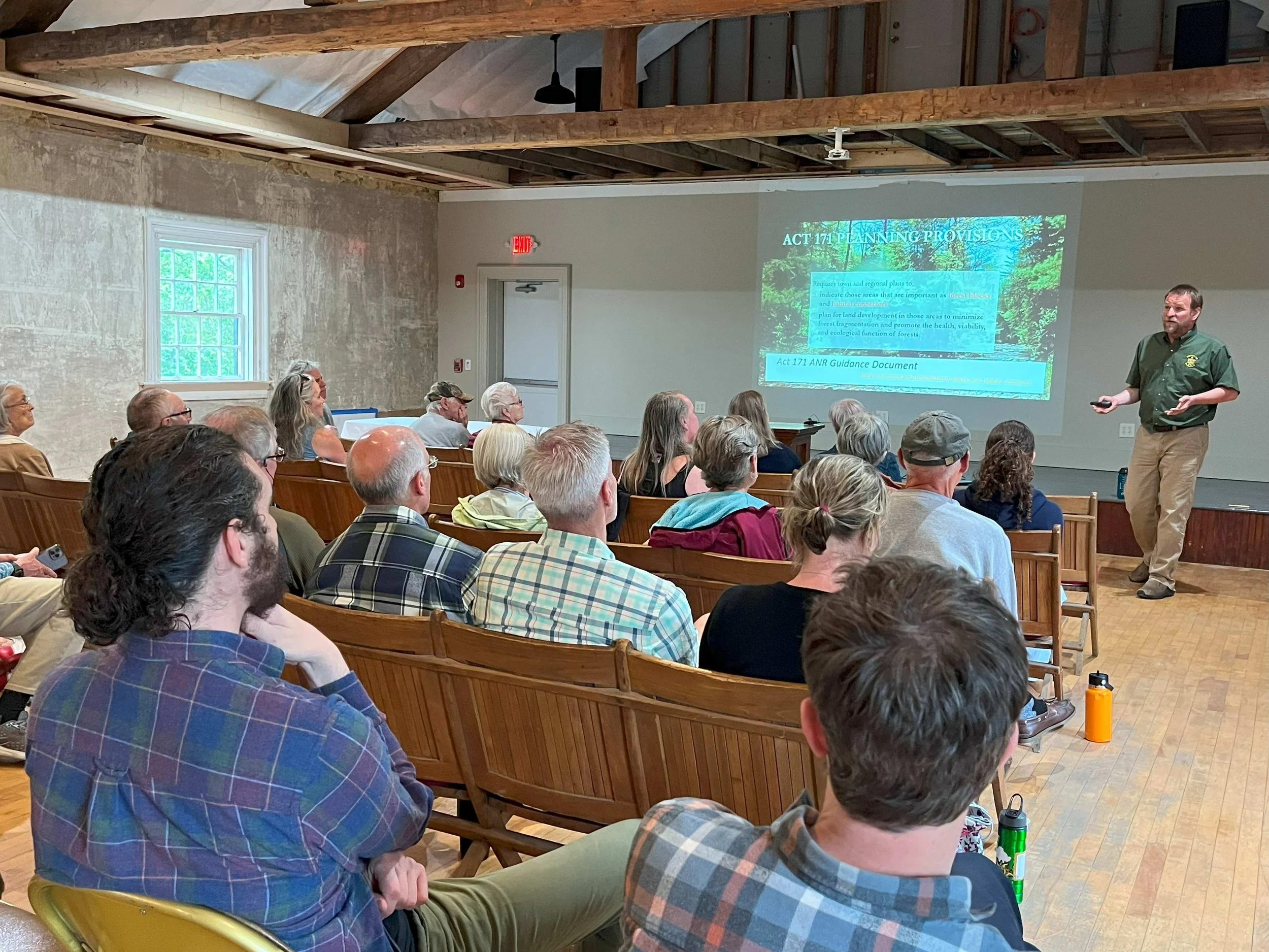
Nearly 30 people attended the Shutesville Hill Wildlife Corridor presentation at the Grange Hall Cultural Center in Waterbury Center in June. Photo by Sandy Yusen
The “Wildlife Corridor” signs along Vermont Route 100 between Waterbury and Stowe may fly under the radar of many passing motorists, but they mark one of the state’s most important ecological zones: the Shutesville Hill Wildlife Corridor.
An event held last month highlighted this key area for wildlife movement and its importance to Waterbury’s future.
Jens Hawkins-Hilke, conservation planner with the Vermont Fish & Wildlife Department, led a lively discussion on the corridor with more than two dozen attendees at the Grange Hall Cultural Center in Waterbury Center. The event was sponsored by the Stowe Land Trust and Stowe and Waterbury’s conservation commissions, partners along with other organizations in a regional conservation effort launched in 2010.
The corridor’s role in wildlife movement
Despite its name, the corridor is a valley between two of the largest forest blocks in Vermont – the Mount Mansfield and C.C. Putnam state forests. It straddles the border of Waterbury and Stowe, just north of the retail cluster around Cold Hollow Cider Mill in Waterbury Center.
It is the only east-west connector between the two north-south forests, enabling animals such as black bear, moose, and bobcat to migrate across the landscape to find food and habitats, propagate, and adapt to climate change.
“Adapting to the climate reality means that we need to have a connected pattern that allows for plants and animals to move in response to climate change,” Hilke said. Ideally, this includes large and smaller forests, wildlife crossings, and a network of rivers and streams with riparian vegetation.
Shutesville fits into this pattern. It has tree cover and wetlands on both sides of Route 100, making it a hotspot for wildlife crossings. “It’s the only place where there are still trees on both sides of Route 100 in the towns of Waterbury, Stowe, and Morrisville,” Hilke said. “So Shutesville really does pop at this landscape level as a priority for connectivity.”
Threats to the corridor
But this vital region is under threat. Vermont’s relative safety from climate change is drawing more residents, increasing traffic and development.
Animals crossing Route 100, which bisects the Shutesville corridor, face dangerous conditions.
In 2015, Hilke said a study by The Nature Conservancy found that the average gap between vehicles was just six seconds. Rush hours often coincide with dawn and dusk, when animals are most active. A state roadkill tracking map shows sparse but notable incidents on this stretch in 2024 including two bears, one of which was struck and died.
Shutesville Hill is also an area of interest for residential and commercial development. The corridor includes land protected by conservation, private parcels, and commercial properties. In 2023, a 50-unit residential development project was proposed for the property on the west side of Route 100 near the Waterbury-Stowe Fish & Game Club. It was withdrawn after one public hearing before the Waterbury Development Review Board where both board members and the public raised many questions and concerns.
“Sprawl is kind of a default growth pattern in Vermont,” Hilke said. “If you don’t control where you want development and where you don’t want development, sprawl is what you get if you don’t control it. And so we really need to think about what we want our landscape to look like.”
Hilke remains cautiously optimistic that through collaboration across Vermont’s roughly 250 municipalities and focusing on the big picture, the pattern of large and small intact forests and connectors can be preserved. “We’re in a good place, if we can maintain what we’ve got,” he says. “So that’s really the strategy at Shutesville, we need to maintain these wildlife populations in the long run and making sure we don’t develop in that last remaining forest is one of the principle ways of getting there.”
Planning for conservation: ‘a balancing act’
Map of the Shutesville Hill Wildlife Corridor, created by the Shutesville Hill Wildlife Corridor Partnership
Hilke advises municipalities, conservation commissions, and planning commissions on integrating wildlife priorities into town planning processes. Both Waterbury and Stowe are currently updating their town plans, which must be revised every eight years. Waterbury’s new plan is expected to be completed in 2026.
The existing Waterbury plan, last updated in 2018 calls Shutesville Hill “one of the most critical documented wildlife corridors” and warns against forest fragmentation. The plan recommends tools like zoning, land management, education, and conservation easements to help protect the region.
In a community survey done last fall as part of the Planning Commission’s planWTB community planning process, respondents ranked natural resources and scenic beauty as Waterbury’s top assets. Wildlife habitat ranked highest among resources to protect.
The Planning Commission now faces the challenge of balancing the articulated values and issues among Waterbury townspeople, some of which could be seen as competing priorities.
“I think of this as a recipe with different ingredients,” Hilke counsels. “The specifics of that recipe are absolutely up to the town to decide. That balancing act looks a little different in each town, and the needs of the town and community values are critically important in this recipe.”
Hilke advised those involved in town planning to understand the ecological features and functions of the region and the contribution of forest resources. “Forests represent this cross-section of values – ecological, community, and economic,” Hilke said, adding that large forest blocks support biodiversity, recreation, clean air and water, and flood resilience. He said that 12% of Vermont’s GDP and 20,000 jobs come from forest-related sectors, and outdoor recreation, tourism, and forest products generate billions of dollars annually. “So we have this strong economic argument for maintaining forests in addition to all of the community benefits,” he said.
Act 171, enacted last year, requires town plans to map forest blocks and habitat connectors, and ensure development minimizes forest fragmentation. Additional municipal planning tools might include limiting development to forest edges, restricting driveway lengths, or creating overlay districts, which would define areas for additional protections.
“You have this opportunity to think about the future of your town and what sort of tools you might employ to maintain the pattern you want to see,” Hilke said.
Zoning: bringing the plan to life
Once Waterbury’s town plan is adopted, zoning regulations will be updated, which will guide the plan’s implementation. The first phase of zoning revisions centered around the Village was completed last year. Phase two encompasses the rest of Waterbury, including Shutesville Hill.
Amy Marshall-Carney chairs Waterbury’s volunteer Conservation Commission which advises town leaders. An eighth-generation Vermonter, Marshall-Carney also owns property in the corridor and she advocates for codifying Shutesville as a protected zone in the next bylaws.
“It's been almost 15 years, and so many different stakeholders on the Waterbury side have taken a swing at this ball to get it locked in and for a variety of reasons, it just hasn't landed,” she says. One tool town planners can use is to create an overlay district, she suggests, that could define clear boundaries and protections and prevent parcel-by-parcel decision-making in an area like Shutesville Hill.
Marshall-Carney points to Stowe as a model, where expert input and aggressive conservation efforts have helped guide development. Last year, the Stowe Land Trust purchased 86 acres in the corridor and will manage it for forest products, wildlife habitat, and ecological health. “I'd love to see us do the same thing on this side of the line,” she said.
Encouraging community engagement and support
Marshall-Carney also sees opportunities for community members to support protection of the Shutesville corridor: conservation easements, current use tax programs, and engagement in town planning. “Anybody who owns land in that space is going to be either excited about this opportunity or concerned about it,” she said.
One missed opportunity, she noted, was funding a natural resources inventory to map Waterbury’s ecological features. The Conservation Commission did not have the budget to undertake this study. “The hardest hurdle isn't knowing what the land looks like. It's taking a position on how to defend the land,” she said. The goal would be to equip leaders with stronger language that helps with decision-making and potential zoning restrictions.
“We're not making any more land, we're making more people, Marshall-Carney said. “And that's a hard decision, to say it's not that I want to restrict access as much as this is an area where this is not negotiable. If this gets ruined, then we're going to have bigger implications than you can even comprehend. The criticality of it cannot be underestimated or understated.”
The word “irreplaceable” was used in a recent town meeting discussion on the topic, she added.
Hilke evokes Vermont’s motto – “Freedom and Unity” and the concept of the commons as shared resources. “We’ve been trying to balance private property rights and the commons since 1791. And it is a balancing act, and it requires attention and thoughtful decision making.” He encourages town planners and decision-makers to “hold onto both ends of that” and take both seriously. “We all stand to lose if we destroy the commons,” he adds.
Waterbury in the larger ecological network
Beyond the education on Shutesville Hill, a primary takeaway from the June 9 event was the global significance of Waterbury’s location with respect to wildlife protection and intact forests.
Long known as a crossroads for recreation in Vermont, Waterbury also is located at a global ecological junction. It sits at a critical fork within the Northern Appalachian Acadian ecoregion, the largest remaining track of temperate broadleaf forest in the world, according to Hilke.
Waterbury’s landscape funnels wildlife north toward the Sutton Mountains of Quebec, and northeast into Maine, he explained. Waterbury’s position on the map makes it stand out as a prime spot for other projects to preserve animal pathways, including enhancing north-south connectivity across I-89 and Route 2 between the Mount Mansfield and Camel’s Hump forest blocks.
The Little River Wildlife Shelf, constructed in 2014 as Vermont’s first wildlife shelf, allows moose, bobcat, coyote, and deer to move beside the stream on a dirt surface covering large rocks under the highway. Another project to enlarge a culvert under Interstate 89 and U.S. Route 2 at Sharkeyville Brook near the Bolton-Waterbury town line was proposed by state agencies but recently was reported to now be shelved due to its high cost and lack of funding.
Building awareness of Shutesville Hill Wildlife Corridor
The June 9 event aimed to build community awareness and understanding of Shutesville’s ecological value. “After over 15 years of talking about the corridor I’m still surprised there are long-time residents in Waterbury that still don’t know anything about it. Or they have heard about it, but maybe not given it the credence it deserves,” Marshall-Carney said.
Hilke believes awareness is growing. Town plans and bylaws across Vermont increasingly include language addressing wildlife connectivity. “So the need for this is well understood among Vermonters, and towns across the state are making it happen,” he said.
Marshall-Carney said she worries that newer arrivals to Vermont may not share that knowledge. She points out that with second-home ownership growing in Waterbury and nearby towns, there’s a need to increase awareness and learning about the importance of the environment and human connection to it.
“My intention in doing presentations like this is to really celebrate what we've got,” Hikle concluded. “And Waterbury is a wonderful, special place, and there are so many incredible resources there, and the forest and the forested connections in Waterbury are really outstanding. So we just have this incredible opportunity, and I just want to celebrate that.”
The June Shutesville Hill Wildlife Corridor presentation is available online and an overview of the corridor can be found here. The state also offers a variety of resources available for those who want to learn more:
Vermont Conservation Design BioFinder: An interactive map of Vermont’s biodiversity and areas of ecological priority.
Mapping Vermont’s Natural Heritage: A guide for municipal and regional planners seeking conservation strategies.
Community Strategies for VT’s Forest and Wildlife: A how-to guide for communities and planning and conservation commissions to take local action.